


Indian Airports
คำอธิบายของIndian Airports
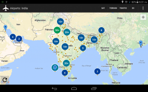
Long press on any location of the map to instantly find its address.
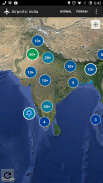
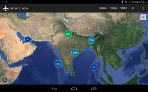
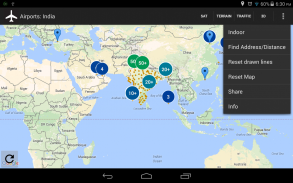
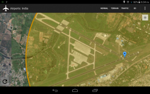
A visual representation of all Indian airports (plus a few important global airports).
It displays all available information about airports in a neat clustered view on top of Google Maps.
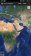
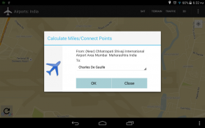
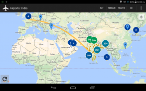
Draw curved lines from any address to any airport and calculate air miles.
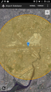
View satellite, indoor, 3D, and terrain views of all airports.
View flights/weather data of any airport.
ลองกดสถานที่ตั้งของแผนที่เพื่อหาที่อยู่ได้ทันทีใด ๆ
การแสดงภาพของสนามบินอินเดีย (บวกไม่กี่สนามบินทั่วโลกที่สำคัญ)
จะแสดงข้อมูลที่มีอยู่ทั้งหมดเกี่ยวกับสนามบินในมุมมองคลัสเตอร์เรียบร้อยด้านบนของ Google Maps
วาดเส้นโค้งจากที่อยู่ใด ๆ ไปยังสนามบินใด ๆ และคำนวณไมล์อากาศ
ดาวเทียมดูในร่ม, 3D, และมุมมองภูมิประเทศของสนามบินทั้งหมด
ดูเที่ยวบิน / ข้อมูลสภาพอากาศของสนามบินใด
Indian Airports--เวอร์ชั่น1.1
(07-12-2018)Indian Airports - ข้อมูล APK
เวอร์ชั่น APK: 1.1แพ็คเกจ: com.indianairportsเวอร์ชั่นล่าสุดของIndian Airports


แอปในประเภทเดียวกัน


